Europe map: mean elevation of countries

Europe map: mean elevation of countries
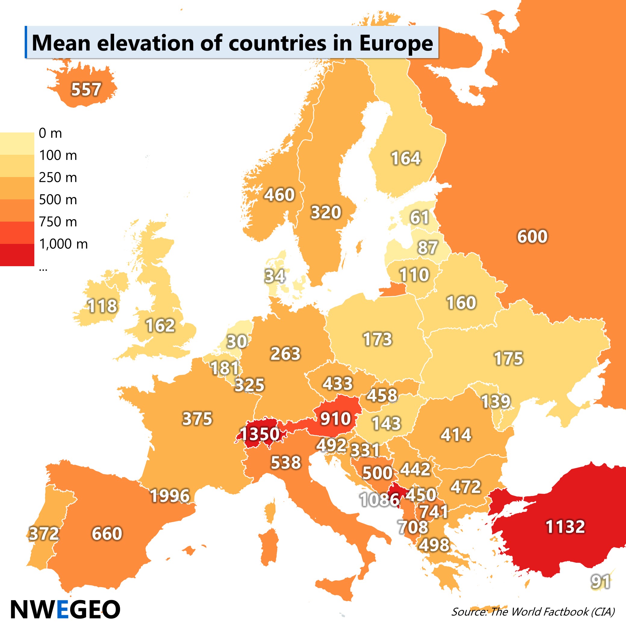
This map shows the mean elevation of countries in Europe.
Note: some small states are not included due to missing data.
Top 5 (highest mean elevation):
- Andorra (1996)
- Switzerland (1350)
- Turkey (1132) – Note: mainly in Asia
- Montenegro (1086)
- Austria (910)
- North Macedonia (741) – Note: no. 5 when Turkey is not included
Top 5 (lowest mean elevation):
- Netherlands (30)
- Denmark (34)
- Estonia (61)
- Latvia (87)
- Cyprus (91)
Source: The World Factbook
Map created by NWEGEO; administrative boundaries and fill colours by Mapchart.net. This work is licensed under a Creative Commons Attribution-ShareAlike 4.0 International License (CC BY-SA 4.0).
