Netherlands map: Dutch Wadden Islands

CLICK FOR DUTCH TRANSLATION
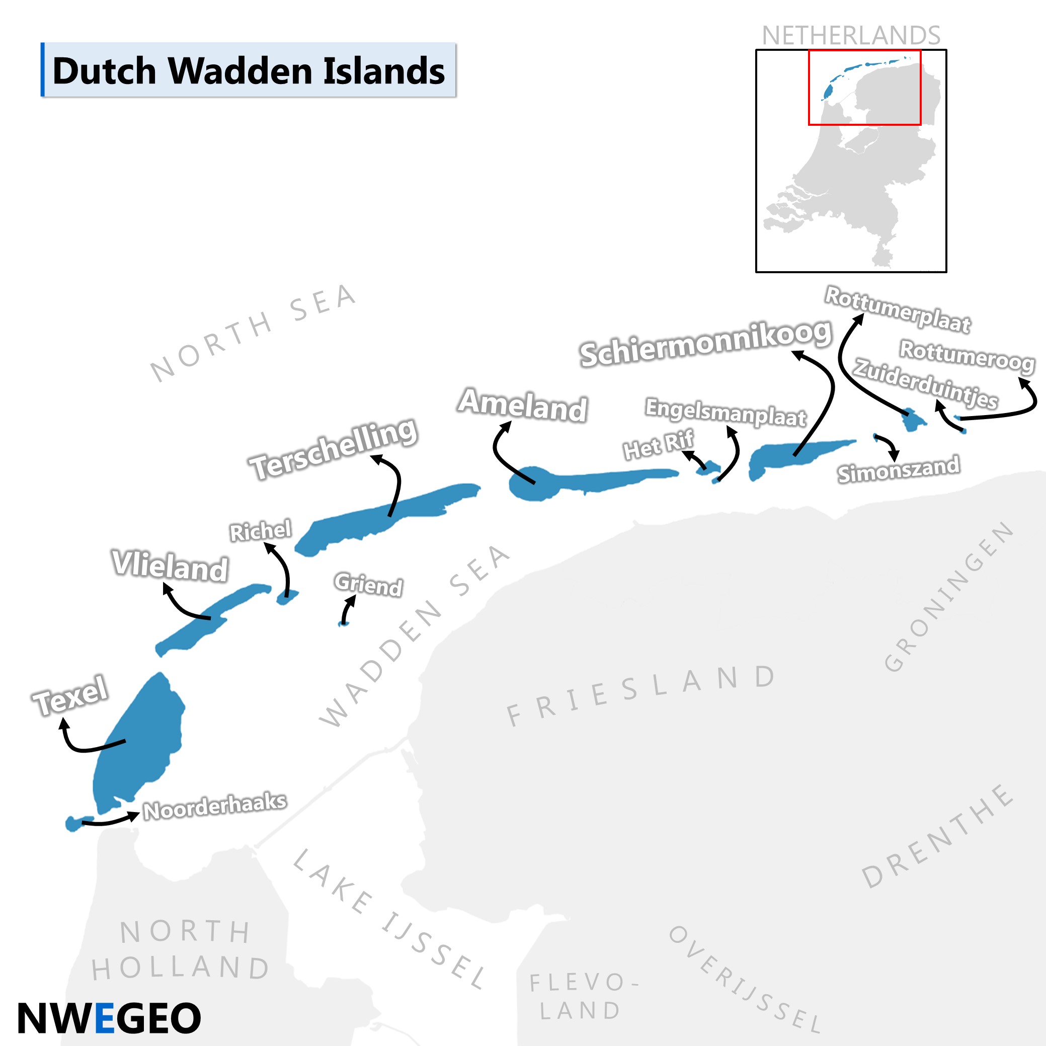
Netherlands map: Dutch Wadden Islands
This map shows the Dutch Wadden Islands (Dutch: Nederlandse Waddeneilanden), an archipelago in the north of the Netherlands, at the southeastern edge of the North Sea. The Wadden Islands continue, via Germany, to western Denmark.
Inhabited (from West to East)
- Texel
- Vlieland
- Terschelling
- Ameland
- Schiermonnikoog
Uninhabited (from West to East)
- Noorderhaaks
- Richel
- Griend
- Rif
- Engelsmanplaat
- Simonszand
- Rottumerplaat
- Rottumeroog
- Zuiderduintjes
The uninhabited islands of Noorderhaaks, Rottumerplaat and Rottumeroog are generally considered to be islands, just like the inhabited islands. The other islands are considered to be sandbars.
Map created by NWEGEO; administrative boundaries and fill colours by Mapchart.net. This work is licensed under a Creative Commons Attribution-ShareAlike 4.0 International License (CC BY-SA 4.0).

